Just for the fun of it, this post will start with a global view, then zoom in more and more and end with local photographs of the Salmon Area. Be sure to click on the links -- they open to satellite views from FlashEarth, which you can zoom in and out to see greater and lesser detail. (Note: links are in blue)
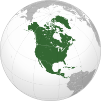 |
| North America |
North America is bounded by the Pacific Ocean to the west, the Atlantic Ocean to the east, the Arctic Ocean to the North and the Caribbean Sea to the South.
North American countries include: Antigua & Barbuda, Bahamas, Barbados, Belize, Canada, Costa Rica, Cuba, Dominica, Dominican Republic, El Salvador, Grenada, Guatemala, Haiti, Honduras, Jamaica, Mexico, Nicaragua, Panama, St. Kitts & Nevis, St. Lucia, St. Vincent & The Grenadine, Trinidad & Tobago, and the United States of America.
.svg/220px-Canada_(orthographic_projection).svg.png) |
| Canada |
West to east, there are ten provinces in Canada: British Columbia, Alberta, Saskatchewan, Manitoba, Ontario, Quebec, New Brunswick, Prince Edward Island, Nova Scotia, and Newfoundland-Labrador. In the far north, there are three territories: Yukon, Northwest Territories and Nunavut.

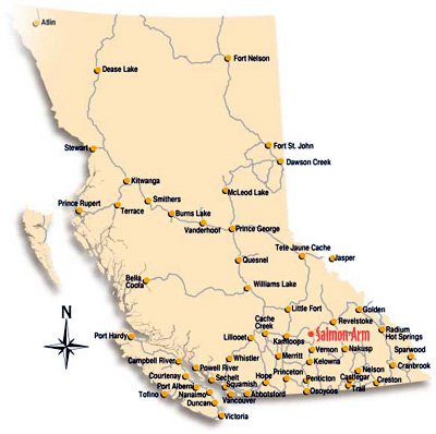 |
| Map of British Columbia showing the location of Salmon Arm. |
It gets its name from the Shuswap Lake, which has four long arms, one of which is named the "Salmon Arm," the arm that connects to the Salmon River.
Salmon Arm is part of the Columbia-Shuswap Regional District, which include the cities of Salmon Arm, Sicamous, Revelstoke, Golden.
Smaller communities include: Anglemont, Blind Bay, Celista, Craigellachie, Eagle Bay, Falkland, Malakwa, Notch Hill, Ranchero, Scotch Creek, Silver Creek, Sorrento, Sunnybrae, Swansea Point, Tappen and White Lake.
It is a 5 to 6 hour drive to Vancouver, on the west coast of British Columbia and a 6 - 7 hour drive to Calgary, Alberta.
It is a four season area, with distinctive weather for spring, summer, autumn and fall.
It can be remarkably hot in the summer time and yes, it snows in the winter, with the first snows usually arriving in mid December and sticking around until late March.
The Shuswap region is drop-dead beautiful with its pine forests, mountain plateaus and fresh water lakes.
 |
| The Salmon River, where it connects with the Shuswap Lake ~ Photograph by Sharlee Plett |
 |
| The Shuswap River at Enderby, B.C. ~ Photograph by Sharlee Plett |
No comments:
Post a Comment